The product utilizes a MEMS inertial measurement unit (IMU) and an external (internal) GPS/BDS positioning module in a combined navigation system. HX Gyro inertial navigation system is capable of measuring the attitude, heading, speed, and position of the carrier, characterized by its compact size and high precision. The system internally integrates various sensors such as gyroscopes, accelerometers, magnetic compasses, temperature sensors, etc., and employs a high-performance, small-sized microcontroller unit (MCU). It features adaptive wide-range power supply input and can interface with external auxiliary information such as an odometer.
Features
-
Strong Anti-Interference Capability: The system delivers stable and reliable magnetic heading information. Even in the event of satellite signal loss, it continues to provide dependable navigation data for up to 3 minutes, ensuring uninterrupted performance.
-
Superior Performance: With a horizontal attitude measurement accuracy of 0.02° (RMS) and azimuth accuracy better than 0.1°, the system guarantees precise and consistent results under various conditions.
-
Robust Operating Range: Thanks to advanced silicon micro-MEMS devices, the system exhibits excellent resistance to vibration and impact, maintaining high reliability in demanding environments.
-
Versatile Application: The system can operate with either an internal or external GPS/BD2/GLONASS triple-mode navigation module. This flexibility, combined with high tracking sensitivity, makes it ideal for positioning and navigation in open areas, as well as in complex environments such as urban streets or dense jungles.
-
User-Friendly Experience: Moreover, system parameters can be easily configured via an upper computer, with adjustable output bandwidth and protocol. It also supports online program updates and parameter customization, ensuring convenient operation and adaptability for diverse applications.
Specifications
| Performance Indicator | Notes | |
| Pitch Angle Measurement Range | -90° to +90° | |
| Roll Angle Measurement Range | -180° to +180° | |
| Heading Angle Measurement Range | 0 to 360° | |
| Horizontal Attitude Accuracy | <0.02° (RMS) | under good satellite signal conditions |
| Heading Angle Accuracy | <0.1° | under good satellite signal conditions |
| Horizontal Attitude Maintenance Accuracy | <1°/h (30 minutes) | in pure inertial navigation |
| Heading Angle Maintenance Accuracy | <1°/h (30 minutes) | in pure inertial navigation |
| Position Accuracy | <1.8km (15min) | in pure inertial navigation |
| Velocity Accuracy | 0.05 (1σ) | |
| Position Accuracy | 1.5 (1σ) | |
| Altitude Accuracy | 3 (1σ) | |
| Operating Temperature | -50°C to +70°C | |
Applications
- Autonomous navigation and positioning of aircraft and helicopters
- Ship navigation and heading maintenance
- Attitude Control of Missiles and Unmanned Combat Systems
- Geological exploration and mining construction positioning
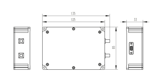
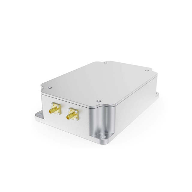
Diagram